Tuesday, March 18, 2014

Precipitation Map of El Salvador

Precipitation Map of El Salvador
Source: http://www.zonu.com/mapas_el_salvador/El_Salvador_Rainfall_Map_2.htm

You can click on the link to display the original size image.

Soils Map of El Salvador

Soils Map of El Salvador
Source: http://www.madrimasd.org/blogs/universo/wp-content/blogs.dir/42/files/370/o_Mapa%20de%20Suelos%20de%20El%20Salvador.jpg

Three peer-review articles about the management of the ecosystems in El Salvador

1. Status of conservation of Agalychnis moreletii in El Salvador
Available from: http://www.marn.gob.sv/phocadownload/pp_nn_1.pdf

This report describes the status of conservation of Agalychnis moreletii, which is a species of frog, in El Salvador. The report was written by Nestor Herrera from the Department of Natural Resources of El Salvador.

2. Current status of the natural protected areas in El Salvador
Availablefrom: http://www.marn.gob.sv/index.php?option=com_phocadownload&view=category&download=73:i-informe-
nacional-del-sistema-de-areas-protegidas-de-el-salvador&id=13&Itemid=79

This report is based on a national research in El Salvador executed by the Department of Natural Resources and evaluating the status of the natural protected areas.

3. Status of knowledge of biodiversity in El Salvador
Available from: https://www.inbio.ac.cr/web-ca/biodiversidad/el-salvador/salvador.pdf

This is an important article that the describes the current situation of the biodiversity of El Salvador. It was conducted by the National Institute of Biodiversity financed by the Norway Government.

Three peer-review articles about the environment in El Salvador

1. Did the Ilopango TBJ Eruption Cause the AD 536 Event?
This article explains the evidence that the eruption of the volcano Ilopango TBJ (a caldera lake located in El Salvador) caused a significant decrease in the temperatures in the northern hemisphere in AD 536. A dust veil covered the Earth surface and caused a drop in temperatures during the summer in the northern hemisphere and affected crops in China and the Mediterranean. The scientist Robert Dull from the University of Texas traveled to El Salvador to find the geological evidence by drilling tephra samples (ash layers underground) and a carbonized tree trunk. These samples were tested with Radiocarbon dating to estimate the age of the eruption. The result of the experiment found that the eruption of the Ilopango volcano was in AD 535 but the sample of the carbonized trunk “cannot be unequivocally associated with the 536 AD event.” The conclusion of the research remarks that “the eruption alone probably cannot explain the entire +14 year cold period observed in the northern hemisphere tree rings record from AD 536, but it seem now the best candidate for the cause of the AD 536 mystery cloud and a major contributor to the cold temperatures that followed.

Source:
Robert Dull, 2012. Did the Ilopango TBJ Eruption Cause the AD 536 Event? University of Texas, Austin. [Internet]. Available from: http://www.fundar.org.sv/referencias/dull_et_al_2010_AGU.pdf

2. Sustainable Development in El Salvador
This is a research done by Neşecan Balkan and Gwyn Kirk about the overall situation of sustainable development in Central America and in El Salvador, with some principles and strategies of how this is being implemented.

Source: Neşecan Balkan and Gwyn Kirk. 2005. SUSTAINABLE DEVELOPMENT IN EL SALVADOR: PRINCIPLES AND PRACTICE. [Internet]. Available from: https://www.hamilton.edu/documents//levitt-center/salvador_finalreport.pdf

3. CAFTA Investor Rights Undermining Democracy and the Environment: Pacific Rim Mining Case
This peer-review article describes how the company Pacific Rim Mining Case was trying to damage the natural environment and pollute the Lempa River with a gold mine, but they could. Here are some reasons why they were unsuccessful.

Available from: https://www.citizen.org/documents/Pacific_Rim_Backgrounder1.pdf


Three popular articles about the ecosystems or environment in El Salvador

1. Citizens ask for more attention towards the environment from the Government
http://www.laprensagrafica.com/2014/02/28/piden-mayor-atencion-hacia-medio-ambiente

This article from a local newspaper describes how citizens of El Salvador are asking the government to pay more attention to environmental issues, and make it a priority in their political agenda.

2. El Salvador obtains financing from Germany to support the environment
http://www.laprensagrafica.com/2014/03/12/apoyo-aleman-para-el-medio-ambiente

This article from a local newspaper describes that the Government from Germany signed a covenant with El Salvador to finance $28 million to invest them in the protection and restoration of the Mesoamerican Biological Corridor.

3. Chaparrastique volcano is still active
http://www.laprensagrafica.com/2014/01/27/se-mantiene-la-actividad-del-volcan-chaparrastique

This article from a local newspaper describes how the Chaparrastique volcano located in Eastern El Salvador is still active after one month of the first eruption. This article is from January 27 2014, and the eruption occurred on December 15 2013


List of threatened and endangered species

This is a list of all the threatened and endangered species in El Salvador (the following table is my personal work researching in some webpages).


Description of the ecosystem where I live

The ecosystem where I live is classified as Evergreen Submontane Forest, according to the map of Vegetation and Ecosystems of El Salvador prepared by the Natural Resources Department (MARN). The range of elevation goes from 700 to 1900 meters above sea level. The range of temperatures goes from 30°C in the foothills to 10°C in the upper part of the mountain. The average precipitation can reach the 2000 mm of rain. The humidity is always high. In the dry season, high humidity and clouds help maintain the forest moist. Few species of deciduous trees live in this forest, most of the area is covered by evergreen hardwoods. In some parts, the abundance of understory and vines become the forest in jungle hard to walk through. The slopes of this forest are very steep. Several creeks are born in this forest.

The forest that I am describing is called El Picacho Mountain, and this is the closest natural ecosystem close to my community (because I live in an urban environment). Coffee plantation grow adjacent to this forest, threatening to disturb the natural environment of this wilderness. My CAP project is about designating this forest as a natural protected area. The wildlife living in this forest is very representative: big mammals like White Tailed Deer are still found in this forest, as well as armadillo and coyote, a huge variety of birds, and some species of snakes, like Rattle Snake, Coral, and Boa Constrictor. Centennial hardwoods (old growth forest) is found in this region, because there has never been human activities.

Representative pictures of the ecosystems of El Salvador

1. Evergreen Submontane Forest
Source: http://www.territorioscentroamericanos.org/turismorural/PublishingImages/Belen-PN%20Celaque.jpg

2. Evergreen Montane Cloudy Forest
Source: https://blogger.googleusercontent.com/img/b/R29vZ2xl/AVvXsEjhvCjJq8KbyVxIQE_k1GSiJL_SZQpyz_1aSGj40OMJY3uUQn5xTdwgCCRzwRXecwi-u5Vt9nnG-ct1YWJoWnLX3nHHvr-Uod0YJzFGJKxcb2cVYyPoh_FMbEop-Ctl-gDUETY9_pYy9OI/s1600/bosque-nuboso2.jpg

3. Riparian Forest
Source: http://www.fotonatura.org/galerias/fotos/usr20869/11896354XY.jpg

4. Humid Subtropical Forest
Source: https://blogger.googleusercontent.com/img/b/R29vZ2xl/AVvXsEgSxSaUA42LcwM0ZIdFYJHXYtb3a284r_AmsUHlQUCQw4UdpfS4FqN2S1bZOdbY8oJhrWpItLxpl6kAuQOTaUueOHCJoSpAHjThRzEZy0lA2hfEMXik4w4YH4N1OP9eJTKQ9iAkub7Fg3ew/s1600/Bosque+del+R%25C3%25ADo+Cuyamel.JPG

5. Sub Deciduous Forest
Source: http://upload.wikimedia.org/wikipedia/commons/7/78/Chacachacare_dry_forest_3.JPG

6. Mangrove
Source: http://static.panoramio.com/photos/large/7360922.jpg

7. Low Elevation Deciduous Forest

Source: https://www.marietta.edu/~biol/biomes/images/tropseas/a80_cr_0239.jpg

8. Conifer forest (pines)
Source: http://www.barkbeetles.org/centralamerica/figure10.jpg

9. Chaparral
Source: http://anthromes.wikispaces.com/file/view/50-25d-Chaparral.jpg/135133305/50-25d-Chaparral.jpg

10. Savanna
Source: http://www.bilgiufku.com/wp-content/uploads/Savan-bitki-%C3%B6rt%C3%BCs%C3%BC.jpg

11. Lava fields
Source: http://pajoka.com/blog/wp-content/gallery/2012_03_batur/cimg8462.jpg

12. Wetlands
Source: https://blogger.googleusercontent.com/img/b/R29vZ2xl/AVvXsEhoajC46ObMLLJ9k3k899MY-Lt-UmtDF5Wt6hOv9FEZRRPNOHZbUjsvDxBctYg-HbuSJhdzo-W2HOExgREAujS9rU9ve1EkrcK33s-OSitdUQteiD4_RtEoSmvVUjONadFJAgVGbR7bSeA/s1600/El+Jocotal.jpg

13. Rocky Reefs
Source: http://fotosdeelsalvador.com/fotos/water/b5aad693f72be4b0602c34c071787ad2.jpg


Monday, March 17, 2014

Ecosystem map of El Salvador

Ecosystem map of El Salvador

Source: http://www.zonu.com/mapas_el_salvador/El_Salvador_Natural_Vegetation_Map_2.htm

Information about the Biome

1. List of average, high and low range of temperature for each biome in your home country


2. List of average, high and low range of precipitation for each biome in your home country


3. Highest elevation in your country
Cerro El Pital 2,730 meters above sea level

4. Lowest elevation in your country
- Pacific coast 0 meters above the sea level


5. Latitude and longitude of where you are from
 13°43'50.74"N
 89°13'28.14"W


Wednesday, March 12, 2014

Map of Biomes

El Salvador belongs to the Tropical Rainforest Biome. Here is an image showing the tropical rainforests of the world, and the location of El Salvador

Source: http://upload.wikimedia.org/wikipedia/uk/c/ce/Tropical_rainforest_map.png


Political Map of El Salvador

Political Map of El Salvador


Source: http://www.portalsaofrancisco.com.br/alfa/mapa-de-el-salvador/5.jpg

Country Specific Blog - Tropical Ecology Final Project

Tropical Ecology Final Project
Country Specific Blog

By Daniel Chavarria
March 2014

El Salvador


Monday, February 17, 2014

Lab #5 Germination and Productivity

Part 2 Lab Write Up

1.      What was our CONTROL for this experiment?
The control of this experiment was the presence or absence of light. Two samples were placed in a dark room (no natural or sunlight were allowed) and the two other samples were place in a light room where sunlight could go through (located next to a window).

2.      What is the percent germination for the LIGHT TREATMENT? For the DARK TREATMENT?
Total of seeds that germinated = 69
Total of seeds planted = 144
Percentage of germination = (/144)*100 = 48%

Percent germination for dark treatment:
      Total of seeds that germinated = 94
      Total of seeds planted = 144
      Percentage of germination = (94/144)*100 = 65.28%


3.      Compare the difference in appearance in the dark treatment and the light treatment plants
The light treatment plants look green and fresh. The dark treatment plants look yellowish, blown color and the stem is a little bended.

4.      If there was growth in the dark treatment plants, explain why that growth may have taken place even though light was not reaching the plants.
There was growth in dark treatment because the seeds have enough energy stored to produce the germination of the seedling, so the growth of the seedling is not the result of sunlight, is the result of the energy stored in the seed.

5.      GPP = NPP + R
NPP = 2.0 g.
R = 18.9 g.

GPP = 2.0 g. + 18.9 g.
GPP = 20.9 g.


6.      Graphs:


Saturday, February 1, 2014

Lab 4: Field Trip to Marmot Dam Site - Sandy River

Marmot Dam Site after 6 years of the removal

The Marmot Dam was built in 1913, and it was removed in 2007. Before that, the area was logging land. The dam was operated by PGE (Portland General Electric), and all the land around was also owned by PGE. Environmental agencies realized that the dam was obstructing the natural flow of salmon upstream, and they proposed to remove the dam to let the river flow free. Finally in 2007 the dam was removed, the land was acquired by the Western Rivers Conservancy, and then transferred to the federal government to be restored.

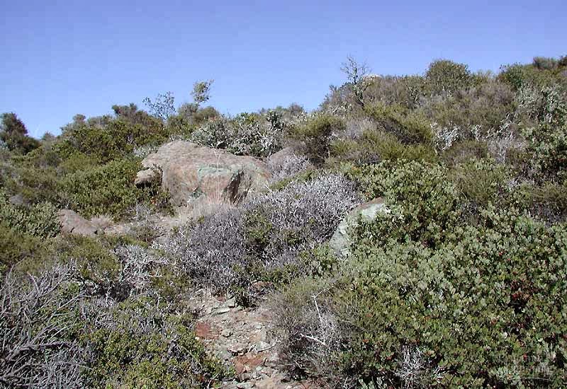
After almost 7 years since the removal, the area doesn't appear like it had a man made structure in the past. The Sandy River flows free, and there is no major obstruction of sediments. The land on the north of the river is recovering, trees have been planted in the land where there used to be a building. This building was also removed, the cement was broken and the soil was treated to avoid compaction, so the new seedlings can grow. To the south of the river, the forest looks intact. Mossy Western Redcedar and Big Leaf Maple trees cover the shaded ground where Sword Fern grows.

The reason why the dam was removed is because it was obstructing the flow of salmon upstream. The Sandy River offers primordial habitat for four species of salmon: Spring Chinook, Fall Chinook, Steelhead, and Coho. A salmon ladder was built for salmon to swim upstream, but this was not really effective. PGE realized that the expenses of removing the dam were significantly lower than the expenses of operating the dam.

Succession is taking place now. The soils where the building was are now more fertilized, and the young seedlings are growing, some of them are reaching about 5 feet tall. There are a few invasive weeds in the area like Vinca, Scotch Broom, and Himalaya Blackberry. The Sandy River Basin Watershed Council is working in removing the noxious weeds and restoring the site. They have an idea, they want the replanted area to grow, and when the trees are mature, they are going to build some facilities like campgrounds, a boat ramp and a kiosko, but vegetation succession has to be fully in place.

Steve Wise was explaining about the hydrology and geology of the Sandy River. The river originally serves as a channel for lahar coming from Mt Hood. The river has its source in the Sandy Glacier. The glacier erodes the rocks of the mountain and deposits huge amounts of sediments into the river (that is why it is called “Sandy”). The last lahar was about 300 years ago. The bottom of the river is very young; the rocks are composed mainly by basalt. After the removal of the dam, most of the sediments were washed downstream in just a couple of days after. These did not affect the wildlife of the river because of the natural sedimentation regime of the river and the low toxicity content. The sediments found today are from after the dam removal.

The forest is categorized as late succession according to Steve Wise. The average age of the trees is about 200 years, so the forest is not considered old growth. The dominant species is Western Redcedar (Thuja plicata) and Big Leaf Maple (Acer macrophyllum). The forest floor is composed of woody debris and a thick and soft layer of humus (dead needles and leaves). The canopy is very open, so there is plenty of sunlight reaching the forest floor. The understory dominant species are Sword Fern (Polystichum munitum) and Huckleberry. The branches of the trees are covered by thick layers of moss. Some species of fern form roots and soil on the branches of the Big Leaf Maple and create habitat, such as the Licorice fern (Polypodium glycyrrhiza). This is a peculiarity of this forest.

Saturday, January 25, 2014

Popular Media Science Reporting and Science Research Articles: Exploring the Relationship

1. Wording used in popular science articles:
  •   The University of Colorado executed a research about…
  •  The WWF reported significant statistics about…
  •  The results of the experiment executed by SalvaNATURA’s scientists revealed that…
  •  Hundreds of fires are burning across Central America according to NASA satellite images


2. Find a popular magazine, web site, or newspaper article


Amazon Rain Forest, Last of the Amazon
Scott Wallace, 2007. Amazon Rain Forest, Last of the Amazon. National Geographic. [Internet]. Available from: http://ngm.nationalgeographic.com/2007/01/amazon-rain-forest/wallace-text

3. Find a popular article related to you country’s ecology


Forest fires burn in Central America
The article is about the fires in several countries in Central America such as Guatemala, Honduras, El Salvador, and Nicaragua. Farmers implement fires in the dry season to prepare the land for agriculture the next season. But these fires are likely to get out of control and expand to other properties including adjacent forested areas. Fires are one cause of deforestation and loss of biodiversity. The UN points out that Honduras, Guatemala, and El Salvador present the highest deforestation rates in the region, losing 1.26 percent of forest annually from 1990 to 2005. A remarkable example in this article refers about a fire that burned a section of Tikal National Park in Guatemala in 2006. Many other Maya Biosphere Reserves in Guatemala have been affected by fires.  I am interested in this article because I have seen examples of fires near my community. In El Picacho Mountain, every dry season farmers start fires to prepare the land for the next season, but this fires end up out of control burning hectares of forest and grassland that can last for several days. I realized that this is a regional environmental issue that threatens the forests and biodiversity of the neotropics.

Source:
Rhett A. Butler, April 10 2006. Forest fires burn in Central America. Mongabay.com [Internet]. Available from: http://news.mongabay.com/2006/0410-central_america.html

4. Find a peered reviewed article of a similar topic than the popular article to your country’s ecology


Did the Ilopango TBJ Eruption Cause the AD 536 Event?
This article explains the evidence that the eruption of the volcano Ilopango TBJ (a caldera lake located in El Salvador) caused a significant decrease in the temperatures in the northern hemisphere in AD 536. A dust veil covered the Earth surface and caused a drop in temperatures during the summer in the northern hemisphere and affected crops in China and the Mediterranean. The scientist Robert Dull from the University of Texas traveled to El Salvador to find the geological evidence by drilling tephra samples (ash layers underground) and a carbonized tree trunk. These samples were tested with Radiocarbon dating to estimate the age of the eruption. The result of the experiment found that the eruption of the Ilopango volcano was in AD 535 but the sample of the carbonized trunk “cannot be unequivocally associated with the 536 AD event.” The conclusion of the research remarks that “the eruption alone probably cannot explain the entire +14 year cold period observed in the northern hemisphere tree rings record from AD 536, but it seem now the best candidate for the cause of the AD 536 mystery cloud and a major contributor to the cold temperatures that followed.

Source:
Robert Dull, 2012. Did the Ilopango TBJ Eruption Cause the AD 536 Event? University of Texas, Austin. [Internet]. Available from: http://www.fundar.org.sv/referencias/dull_et_al_2010_AGU.pdf

My First Blog - Tropical Ecology Class


1.       What are you excited about learning in your tropical ecology class?
I am excited to learn about how interactions in tropical ecosystem occur. How animals interact with the environment, and how this environment affects animals and plants. What are the levels of trophy in an ecosystem (with specific examples). I am also interested in learning about animal behavior in response to the environment, for example, when animals migrate and why? When is the period of breeding and nesting of some animals, and how seasonality affects animal behavior, diet, etc. I also want to learn about scientific research and how the scientific method works, how a scientific research is developed, and how to read and find scientific articles. In general, ecology is an important branch of biology, and tropical ecology is the topic of matter for the SEED students as we all come from the tropics.

2.       What is one of the main environmental issues your community experiences?
As I live in the suburbs of San Salvador city, trash pollution is the major environmental issue in my community. Just behind my house, there is a creek, and this is very polluted. People throw their garbage in the creek and eventually this affects the aesthetics of the place, and when heavy rains come, floods threaten the houses located on the banks of the creek.

3.       What things have your learned thus far to help improve the environmental conditions of your community? (Think about all the classes you have taken and experiences in the field).
When I was an intern last summer in the Sandy River Basin Watershed Council, I learned with their projects about some principles of hydrology. My supervisor explained to me how the depletion of the riparian vegetation in a creek affects making vulnerable to bank erosion and floods. He also gave me some specific ideas to implement in my community. The key is to reforest the banks.

4.       Post a YouTube video related to the ecology of your country (less than 5 min video)

 El Imposible National Park - Ecological Refuge of El Salvador

5.       Post a link of a website that has information of the flora and fauna of your country.

El Imposible National Park - Flora and Fauna